Thanks to all who joined us and made the 2026 conference memorable! The conference Video Presentations are available to attendees.
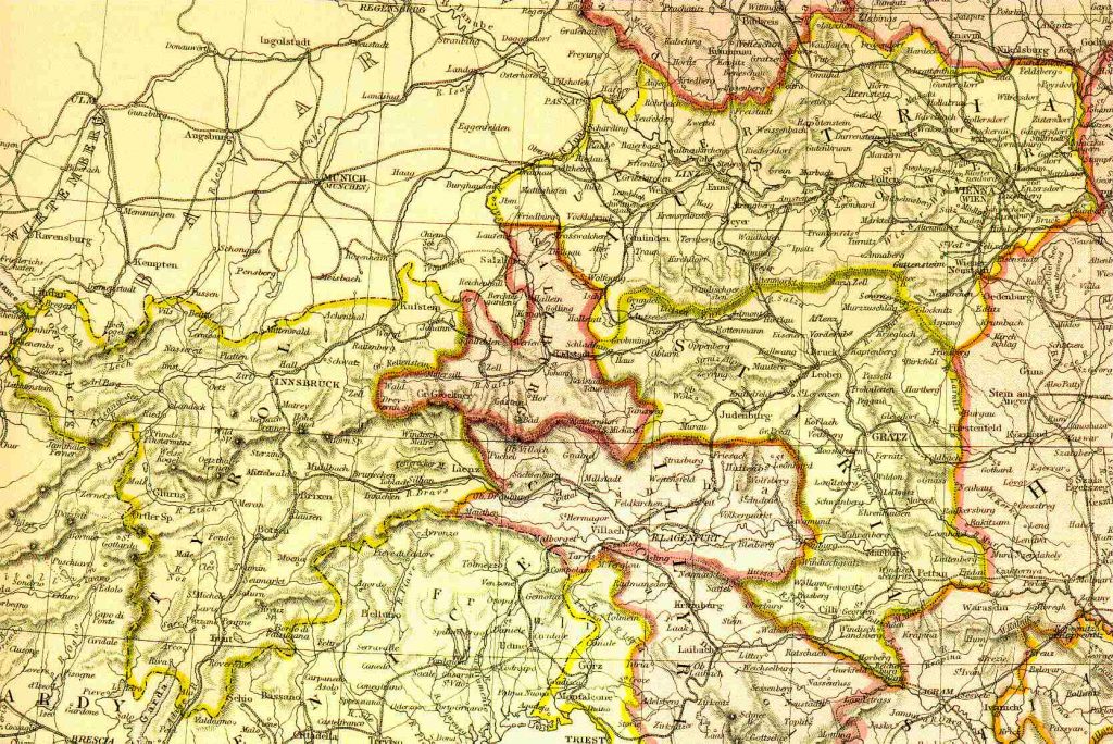
Austria 1882 Austria in 1882
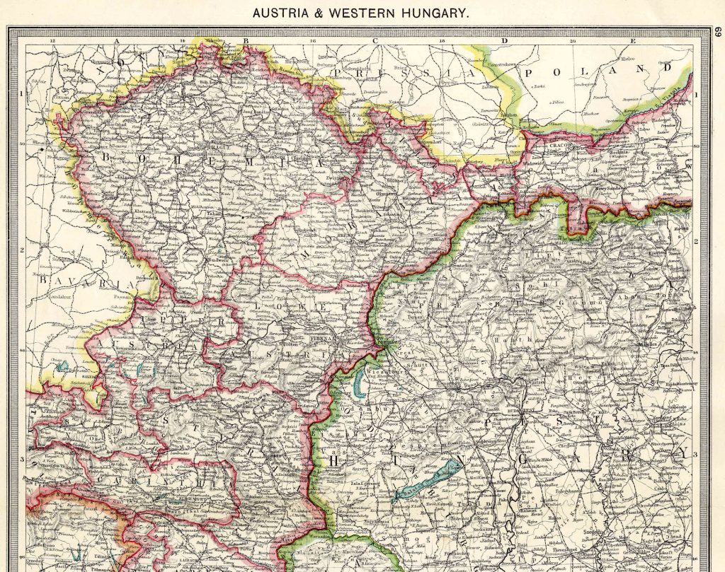
Austria and Western Hungary North 1908 From Harmsworth Atlas and Gazetteer, London, 1909, Scale: 1:2,800,000Download the Hi Res Map and view the Gazetteer
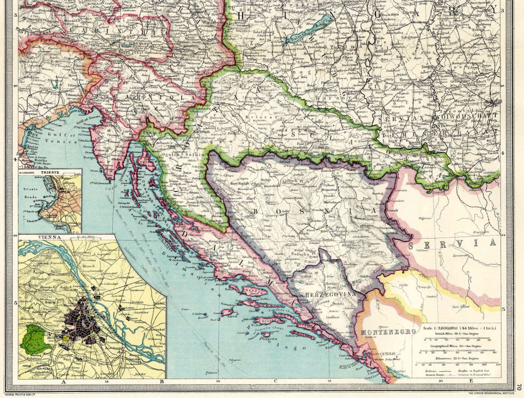
Austria and Western Hungary South 1908 From Harmsworth Atlas and Gazetteer, London, 1909, Scale: 1:2,800,000Download the Hi Res Map and view the Gazetteer
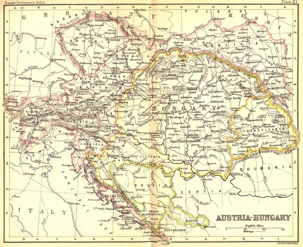
Austria Hungary 1887 From the Reference Atlas of the World, by John Bartholomew (London: J. Walker & Co., 1887)Download a High Resolution Map
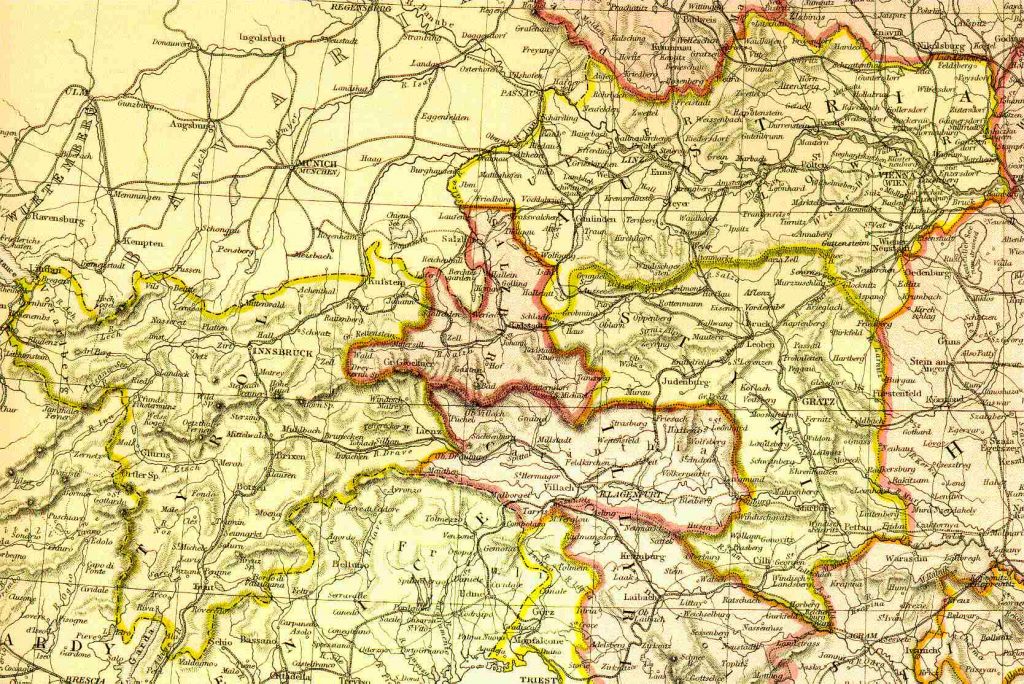
Austria, Styria, Tyrol 1882 From Blackie & Sons Atlas (Edinburgh, 1882), Scale: 1:2,700,000 (or one inch = about 42 miles)
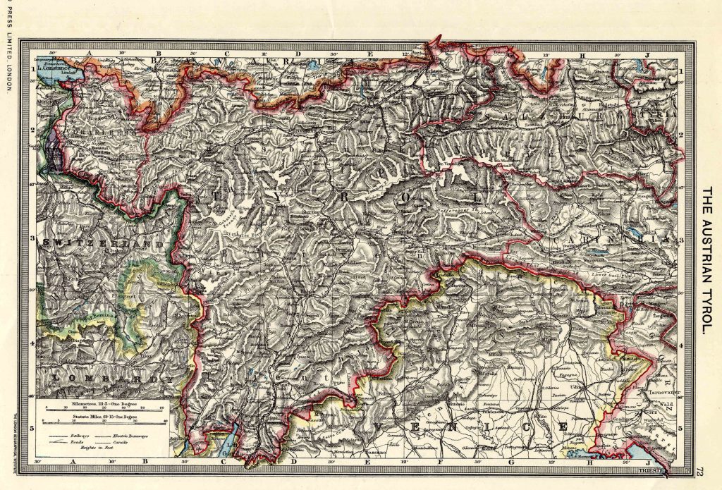
Austrian Tyrol 1908 From Harmsworth Atlas and Gazetteer, London, 1909, Scale: 1:2,800,000Download the Hi Res Map and view the Gazetteer
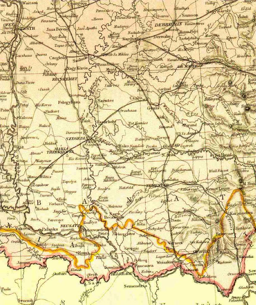
Banat Region, Central Hungary 1882 From Blackie & Sons Atlas (Edinburgh, 1882), Scale: 1:2,700,000 or one inch = about 42 miles
Bohemia 1882 From Blackie & Sons Atlas (Edinburgh, 1882), Scale: 1:2,700,000 (or one inch = about 42 miles)
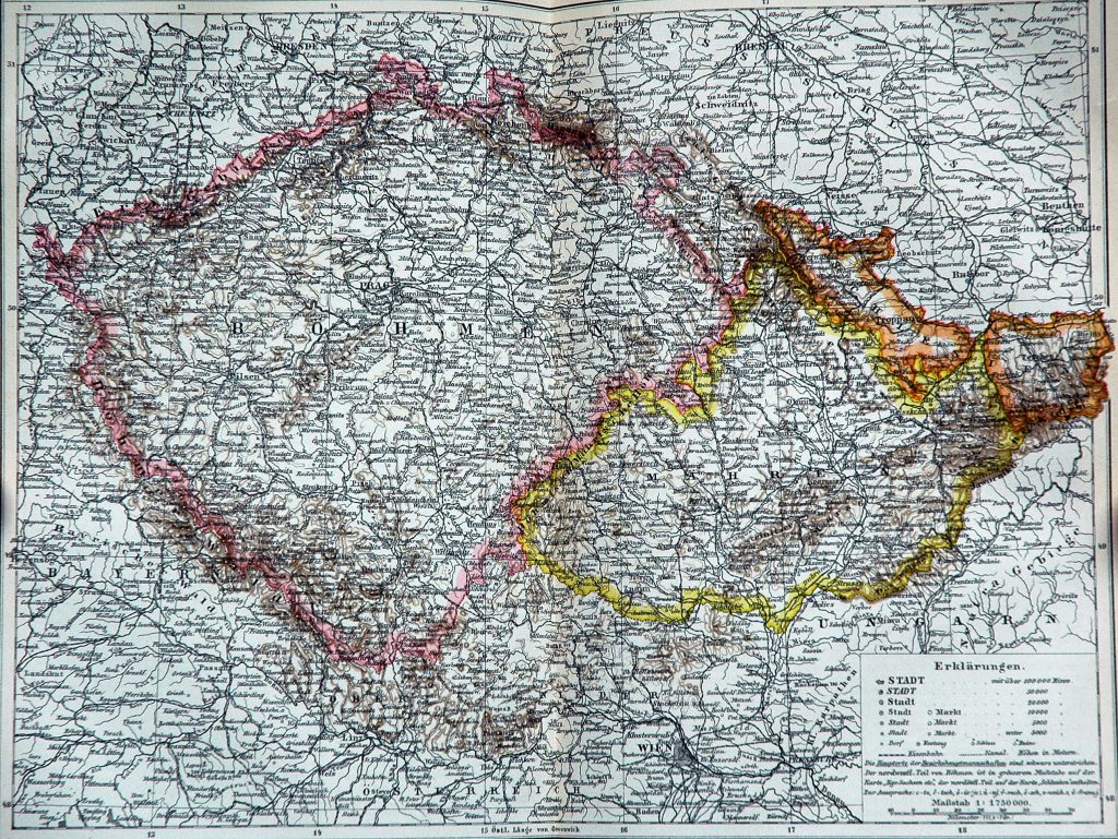
Bohemia and Moravia 1892 Bohemia and Moravia in 1892
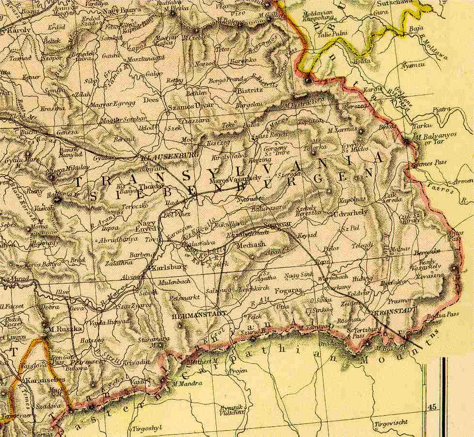
Eastern Hungary - Transylvania 1882 From Blackie & Sons Atlas (Edinburgh, 1882), Scale: 1:2,700,000 or one inch = about 42 miles