Skip to main content
Early bird conference registration has been extended to Sunday, July 12, 2026!
Main navigation
Conference
2026 Announcement
Conference Flyer
Venues and Lodging
Travel
Dining
Venues Map
Registration
Presenters
Schedule by Date - 2026
Schedule by Track - 2026
Archives
FEEFHS Journals
Newsletters
Conferences 2019-Present
Conferences 1995-2018
Photo Gallery
Resources
Resources by Country
Geographic Scope
East Europeans in Other Countries
Germans from Russia
Case Studies
General Information
Immigration
Regions
Banat
Bukovina
Carpatho-Rus'
Galicia
Religions
All Groups
Hutterites
Jewish
Mennonites
Maps
Map Library
Austro-Hungarian Empire
Balkan Peninsula
Europe - General
German Empire
Germans from Russia
Hutterite Places
Russian Empire - Asia
Russian Empire - Europe
Happenings
About
About Us
FEEFHS History
FEEFHS Board
Intro to FEEFHS Video
Contact Us
Search
Search
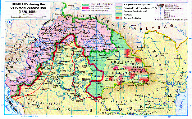
Hungary 1526-1606
Map name
Hungary 1526-1606
Hungary between 1526 and 1606
Map group
Austro-Hugarian Empire