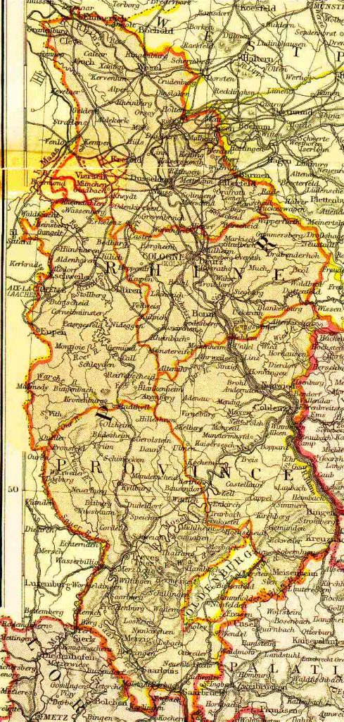
Map name Rheinland, Prussia 1882 From Blackie & Sons Atlas (Edinburgh, 1882), Scale: 1:1,800,000 (or one inch equals about 28 miles) Map group German Empire